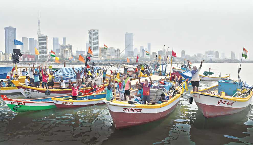

A decades-old land rights dispute in Mumbai’s Worli Koliwada has moved into a crucial implementation stage, with authorities initiating detailed land demarcation in compliance with judicial directions. The exercise is seen as a major step toward formal recognition of customary land ownership in one of the city’s oldest fishing settlements, while also drawing attention to wider issues of heritage preservation, inclusive urban development, and land governance in high-density coastal cities.
Officials from the district administration have begun internal mapping of land parcels across Worli Koliwada, following orders issued by the Bombay High Court. The demarcation covers the entire village area recorded under a single survey number and is required to be completed within a court-specified timeline later this month. Urban governance specialists describe the development as significant, as it attempts to align long-standing habitation patterns with formal land records in Mumbai’s core urban zone.
The dispute traces its origins to more than 50 years ago, when residents first approached the courts seeking protection against what they alleged were attempts to encroach upon and reclassify village land. The community has consistently argued that Worli Koliwada qualifies as a traditional gaothan, placing it outside the ambit of municipal control and slum redevelopment frameworks. In the absence of updated records, households remained exposed to redevelopment pressures and legal ambiguity for decades.
According to officials overseeing the exercise, the current phase involves internal demarcation, including the measurement of individual house plots and common-use areas through GPS-enabled surveying. This follows earlier work on defining the settlement’s outer boundaries. Once completed, the process is expected to result in revised property cards that formally record ownership and occupancy, providing long-sought legal clarity.
Urban planners note that the implications extend beyond Worli. Several coastal gaothans across the Mumbai Metropolitan Region face similar risks of misclassification, often leading to redevelopment models that overlook traditional livelihoods. In Worli Koliwada, open spaces support fishing-related activities such as boat storage, net mending, and fish drying, which are central to the local economy.
Officials said compliance reports will be submitted to the High Court after completion. For residents, the survey represents a long-awaited move toward legal security, culturally sensitive redevelopment, and meaningful inclusion in Mumbai’s urban future.
Source: Urban Acres