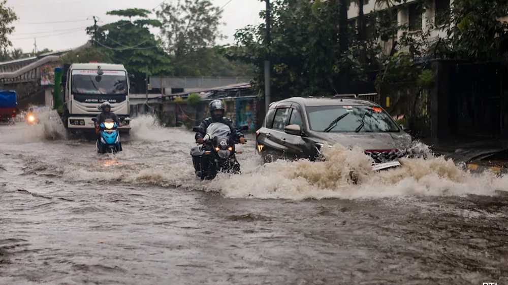

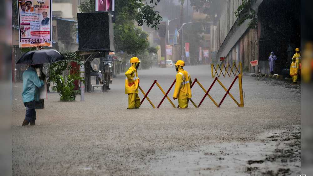
As heavy rains battered Mumbai this week, familiar scenes once again unfolded across the city. Waterlogged roads, flooded subways, stalled vehicles, and delayed train services dominated public discussion, raising a recurring question: why do the same parts of Mumbai continue to flood year after year despite decades of investments in drainage upgrades, desilting operations, and flood-management initiatives?
For many residents, the city’s flood map has become strikingly predictable. Areas such as Hindmata in Dadar, sections of Sion and Kurla, the Andheri and Milan subways, and neighbourhoods surrounding the Mithi River repeatedly feature among the worst-affected locations whenever intense rainfall strikes. These vulnerabilities are neither new nor unexpected; most have been identified for decades.
In the aftermath of the devastating July 2005 floods, when more than 900 mm of rain fell within a single day, authorities introduced a series of measures to strengthen Mumbai’s resilience. These included stormwater drainage improvements, pumping stations, flood-warning systems, emergency response mechanisms, and annual desilting programmes. While these efforts have enhanced the city’s preparedness, they have not fully resolved the problem.
Experts point to geography as one of the primary reasons. Many of Mumbai’s chronic flood zones are naturally low-lying areas where rainwater tends to accumulate. When heavy rainfall coincides with high tide, drainage systems struggle to discharge water into the sea, causing water to back up onto roads and into residential areas.
Rapid urbanisation has further intensified the challenge. Open land that once absorbed excess rainwater has increasingly been replaced by concrete surfaces, reducing natural drainage capacity. Certain infrastructure elements, particularly subways, are also inherently vulnerable because they sit below surrounding road levels and can quickly become collection points during intense downpours.
The Mithi River remains another critical factor. Areas around the river frequently face flooding concerns linked to desilting, encroachments, and limitations in water-carrying capacity. Although annual pre-monsoon maintenance is undertaken, questions remain about whether existing measures are sufficient to handle increasingly severe rainfall events.
Climate change is adding another layer of complexity. Scientists have repeatedly warned that extreme rainfall events are becoming both more frequent and more intense. As a result, infrastructure designed decades ago is often challenged by weather conditions beyond its original capacity.
The impact extends well beyond traffic disruptions. Studies indicate that extreme monsoon rainfall contributes significantly to deaths, health risks, economic losses, infrastructure damage, and livelihood disruptions. Nearly two decades after the 2005 floods, Mumbai may be better prepared, but the persistence of the same flood-prone locations suggests that the city’s underlying vulnerabilities remain unresolved. Until those root causes are addressed, Mumbai’s annual flood cycle is likely to remain a familiar monsoon reality.
Source: NDTV